Route Description
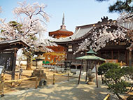
<Main route>Meguro Sta.→Gyoninzaka→Daienji Temple→Banryuji Temple→Gohyaku Rakanji Temple→Jojuin Temple (Tako Yakushi)→Ryusenji Temple (Meguro Fudoson)→Meguro Museum of Art→Chayazaka→Ebisu Sta.
<Shortened route>Meguro Sta.→Gyoninzaka→Daienji Temple→Banryuji Temple→Gohyaku Rakanji Temple→Jojuin Temple (Tako Yakushi)→Ryusenji Temple (Meguro Fudoson)→Meguro Sta.
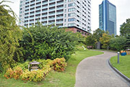
A sightseeing area where shrines and temples depicted in ancient maps and illustrations are still a part of the community
* These are estimates given for a person, weight 60kg, moving at 4km per hour, walking 10 min.=30kcal, one step=70cm.
(pamphlet edition: 9.20MB)
(complete edition: 5.35MB)
* This course is included on P.19-22 of the pamphlet edition of the PDF version of the Walking Map, and P.1 of the complete edition.
* Some details in the PDF walking map may differ from Google Map.
* Contact regarding the PDF walking map offered on this website.
[Meguro City Office / Health Promotion Section TEL 03-5722-9586]