Course Description
Monzen-nakacho Sta. (Exit 2)→Furuishibagawa river Water Park→Etchujima Park→Harumi Bridge→Urban Dock LaLaport Toyosu→Gas Museum Gastenani→Toyosu Sta. (Exit 7)
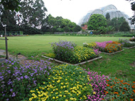
It is a route with many riverside paths and great scenery, and you can feel the pleasant waterfront atmosphere. You can also enjoy changes from the historical Fukagawa area to new Toyosu area.
* The time, calories consumption, and number of steps for each walking course were calculated using speed of 4 km/h, walking 10 minutes = 30 kcal, one step = 70 cm and a body weight of 60 kg.
(10.2MB)
*These courses are listed on P. 37 and 38 of the PDF Walking Map.
* Some details in the PDF walking map may differ from Google Map.
* Contact regarding the PDF walking map offered on this website.
[Health Planning Section, Health Promotion Field, Health and Welfare Department, koto City TEL 03-3647-5889]