Route Description
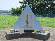
Komae Sta. (North)→ Senryuji Temple→Muikara Folk House Garden→Rokugo Sakura-dori Ave.→Kabutozuka Tomb→Izumi Shrine→Gohonmatsu→Tama-suidobashi Bridge→Izumi-Tamagawa Sta. (North)
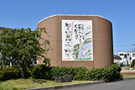
Walk through the area's past and present
* These are estimates given for a person, weight 60kg, moving at 4km per hour, walking 10 min.=30kcal, one step=70cm.
(3.40MB)
* This course is included on P.8 - 9 of the PDF Walking Map.
* Some details in the PDF walking map may differ from Google Map.
* Contact regarding the PDF walking map offered on this website.
[Health Promotion Section, Welfare and Public Health Department, Komae City TEL 03-3488-1181]