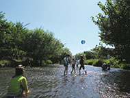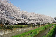

Route Description
Higashi-Kurume Sta. West Exit→Ochiai River (Midori Bridge)→Chikurin Park→Tateno Ryokuchi→Nanbu Regional Center
Greenery and historic Showa period sites situated away from the hustle and bustle
* These are estimates given for a person, weight 60kg, moving at 4km per hour, walking 10 min.=30kcal, one step=70cm.
(5.31MB)
* This course is included on P.5 - 6 of the PDF Walking Map.
* Some details in the PDF walking map may differ from Google Map.
* Contact regarding the PDF walking map offered on this website.
[Health Division, Welfare and Public Health Department, Higashikurume City TEL 042-477-0022]