Route Description
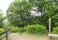
Nagayama Sta.→Kottagawa River→Kotta Kaidori Fureai-kan (Community Center)→Hachiman-jinja Shrine→Tama Center Sta.
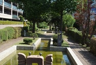
The Kottagawa River, which runs north from the Nagayama Sta. and south down the Tama New Town-dori Ave.
This is a 3.1-km nature walk course that continues down the cherry blossom promenade.
* These are estimates given for a person, weight 60kg, moving at 4km per hour, walking 10 min.=30kcal, one step=70cm.
(0.80MB)
* Some details in the PDF walking map may differ from Google Map.
* Contact regarding the PDF walking map offered on this website.
[Tama City Health Promotion Section Tel 042-376-9139]